
random user submitted photo
In Flight Breakup of N75654 - CAUTION: crash photos
32 posts
• Page 2 of 4 • 1, 2, 3, 4
Re: In Flight Breakup of N75654 - CAUTION: crash photos
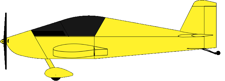
kmacht wrote:One thing that still sticks in my mind a bit is what about the conventional tail Sonex? ... The Sonex uses a very similar piece of angle to hold the front of the horizontal stabilizer down. It looks like they issued a service bulletin that beefed up the angle in that area by using a piece of solid block but they didn't do the same for the Sonex.
Yup, but the conventional tail does not suffer the buildup of loads from two axis that the above describes is subjected to V-Tail designs.
The following buildup presents a simplified example of loading to a V-tail structure while maneuvering. As can be seen, increasing the angle of attack (AOA) will increase the up load on the stabilizers. The up deflection of the ruddervators necessary to increase the AOA would decrease the up loading on the stabilizers. A yaw to the left would decrease the up loading on the left stabilizer and increase the loading on the right stabilizer. Pushing the right pedal would further lower the up loading on the left stabilizer and further increase the up loading on the right stabilizer. The step inputs incorporated into the calculations result in slightly higher than actual values since the AOA and yaw angles would be responding immediately to the start of the movement of the flight controls.
The build-up below follows a simple maneuver – pull the stick aft to increase the AOA, yaw left, followed by moving the stick forward and depressing the right pedal. In this case, the yaw and pedal input approximately double the load to the right stabilizer.
And this is entirely speculation, but the airplane was documented to have been in a climbing, left hand turn when the engine quit. I could at least understand how a pilot would make just the inputs that the above describes to stop the left turn and get the nose down (right rudder and stick forward in an already high AOA condition).

Waiex # 142 - Taildragger, Jabiru 3300
First Flight - July 13th, 2015
450 hours and counting..
First Flight - July 13th, 2015
450 hours and counting..
-

142YX - Posts: 263
- Joined: Thu Sep 01, 2011 10:18 pm
Re: In Flight Breakup of N75654 - CAUTION: crash photos
It looks like the GPS track stopped during the climbout. Strange isn't it? What would cause that besides someone turning off the instrument?
John Gillis
SEL Private, Comm Glider, Tow pilot (Pawnee Driver)
Waiex N116YX, Jabiru 3300, Tail dragger,
First flight, 3/16/2013. 403 hours and climbing.
Home: CO15. KOSH x 5
Flying a B-Model Conversion (Super Bee Baby!)
-

fastj22 - Posts: 1594
- Joined: Sun Aug 21, 2011 5:56 pm
- Location: Mile High
Re: In Flight Breakup of N75654 - CAUTION: crash photos
I thought he had a Dynon D-10 or similar installed. That would have been a goldmine of data had it been recovered...
fastj22 wrote:It looks like the GPS track stopped during the climbout. Strange isn't it? What would cause that besides someone turning off the instrument?
Kip
2010 Waiex 0082 (first flight May 2010)
Jabiru 3300 #1637 and #3035
Dynon D-180
Becker radios
Garmin GDL 82 ADS-B
1175 hours
48 states visited
Based near Atlanta
Also flying a...
2000 Kolb Firestar II, Rotax 503, 575 hours
2010 Waiex 0082 (first flight May 2010)
Jabiru 3300 #1637 and #3035
Dynon D-180
Becker radios
Garmin GDL 82 ADS-B
1175 hours
48 states visited
Based near Atlanta
Also flying a...
2000 Kolb Firestar II, Rotax 503, 575 hours
- N111YX
- Posts: 711
- Joined: Fri Jun 03, 2011 9:43 am
- Location: Atlanta, GA USA
Re: In Flight Breakup of N75654 - CAUTION: crash photos
The retrieved the GPS track from some onboard system.
John Gillis
SEL Private, Comm Glider, Tow pilot (Pawnee Driver)
Waiex N116YX, Jabiru 3300, Tail dragger,
First flight, 3/16/2013. 403 hours and climbing.
Home: CO15. KOSH x 5
Flying a B-Model Conversion (Super Bee Baby!)
-

fastj22 - Posts: 1594
- Joined: Sun Aug 21, 2011 5:56 pm
- Location: Mile High
Re: In Flight Breakup of N75654 - CAUTION: crash photos
I was not trying to answer you but rather just wishing that there was more airspeed/altitude/acceleration data...
fastj22 wrote:The retrieved the GPS track from some onboard system.
Kip
2010 Waiex 0082 (first flight May 2010)
Jabiru 3300 #1637 and #3035
Dynon D-180
Becker radios
Garmin GDL 82 ADS-B
1175 hours
48 states visited
Based near Atlanta
Also flying a...
2000 Kolb Firestar II, Rotax 503, 575 hours
2010 Waiex 0082 (first flight May 2010)
Jabiru 3300 #1637 and #3035
Dynon D-180
Becker radios
Garmin GDL 82 ADS-B
1175 hours
48 states visited
Based near Atlanta
Also flying a...
2000 Kolb Firestar II, Rotax 503, 575 hours
- N111YX
- Posts: 711
- Joined: Fri Jun 03, 2011 9:43 am
- Location: Atlanta, GA USA
Re: In Flight Breakup of N75654 - CAUTION: crash photos
fastj22 wrote:It looks like the GPS track stopped during the climbout. Strange isn't it? What would cause that besides someone turning off the instrument?
fastj22 wrote:The retrieved the GPS track from some onboard system.
The GPS data came from a Garmin Aera 510

A review of radar and Garmin 510 Global Positioning System (GPS) data revealed that the airplane departed IIY about 1239, and the pilot began a gradual, climbing turn to the north. About 2 nautical miles (nm) northeast of IIY, the airplane was observed climbing in left-hand circular patterns until a peak altitude of 4,700 feet above mean sea level (msl) was reached. The airplane then continued on a westerly heading until the GPS stopped recording data. The last two recorded radar returns with altitude data were at 4,600 and 4,300 feet. Prior to the last radar return, the airplane was in a slight descent and accelerated to about 100 to 110 knots ground speed. The GPS did not capture the parameters when aircraft control was lost. The wreckage site was located about 0.11 nm north-northeast of the last radar return with altitude information.
Looking at the data, the GPS was only logging, on average every 7.5 seconds (with a minimum interval of 2 and a maximum interval of 17 seconds) throughout the flight. (this is ignoring the taxi period logs which were even slower on average, and contain a 202 second gap that could have possibly been a power reset). It is entirely possible that the entire crash event could have fit within the logging periodicity of the GPS. I agree with Kip, if there was a Dynon the fidelity would have been much higher.
Source GPS data:


Waiex # 142 - Taildragger, Jabiru 3300
First Flight - July 13th, 2015
450 hours and counting..
First Flight - July 13th, 2015
450 hours and counting..
-

142YX - Posts: 263
- Joined: Thu Sep 01, 2011 10:18 pm
Re: In Flight Breakup of N75654 - CAUTION: crash photos
The Aera is a self contained unit with its own internal power source. So if the aircraft ran out of fuel and engine shut down, it would have no effect on the Garmin from continuing to record the flight path. And since the NTSB was able to recover some of the information up to a point, means the pilot either turned it off at that point or it failed. I doubt the Garmin failed. Or the NTSB haven't released the entire GPS log. Something isn't right here.
I say this because I want to know what happened. I have a very similar aircraft and need to know if overspeed was a factor. Or if he was just happily flying along at cruise and his aircraft broke up.
I say this because I want to know what happened. I have a very similar aircraft and need to know if overspeed was a factor. Or if he was just happily flying along at cruise and his aircraft broke up.
John Gillis
SEL Private, Comm Glider, Tow pilot (Pawnee Driver)
Waiex N116YX, Jabiru 3300, Tail dragger,
First flight, 3/16/2013. 403 hours and climbing.
Home: CO15. KOSH x 5
Flying a B-Model Conversion (Super Bee Baby!)
-

fastj22 - Posts: 1594
- Joined: Sun Aug 21, 2011 5:56 pm
- Location: Mile High
Re: In Flight Breakup of N75654 - CAUTION: crash photos
fastj22 wrote:The Aera is a self contained unit with its own internal power source. So if the aircraft ran out of fuel and engine shut down, it would have no effect on the Garmin from continuing to record the flight path. And since the NTSB was able to recover some of the information up to a point, means the pilot either turned it off at that point or it failed. I doubt the Garmin failed. Or the NTSB haven't released the entire GPS log. Something isn't right here.
I say this because I want to know what happened. I have a very similar aircraft and need to know if overspeed was a factor. Or if he was just happily flying along at cruise and his aircraft broke up.
Agreed, I don't fully know whats up with the released GPS data as it's last altitude point was at 3864 ft and they claim it made it up to 4600 ish feet (based on RADAR data).. and the Aera model line are supposed to have 5 hz refresh rate on their GPS Data.
But as far as it's data logging (and this is just a guess) i think it is some arbitrary waypoint biased logic that looks at distance traveled per speed you are traveling to save to memory for future download so that you can make pretty flight paths without millions of data points in the same spot clouding everything up. This could also explain the 202 second pause, (maybe that was just his run-up) as well as the lower refresh rate during taxi. The in flight breakup and subsequent crash may have just looked like zero velocity to the GPS, so it didn't log it. The Garmin Aera, and its associated propriatary Garmin "Basecamp" software is designed to be user friendly and easy with fun features, vice a bulk-raw-data-outputting flight data recorder.
The altitude discrepancy still bugs me, but its possible the transponder was outputting the wrong information.. His log book states that he had a Garmin GTX-327, which was installed and calibrated in September and October 2010. Who knows what he was using for altitude encoding.. Dynon offers a link between it's D180 and the GTX-327 but Sonex's aren't exactly known for their robust static port placements.


Waiex # 142 - Taildragger, Jabiru 3300
First Flight - July 13th, 2015
450 hours and counting..
First Flight - July 13th, 2015
450 hours and counting..
-

142YX - Posts: 263
- Joined: Thu Sep 01, 2011 10:18 pm
Re: In Flight Breakup of N75654 - CAUTION: crash photos
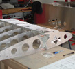
Tragic, but I was just looking back through those photos and the ones where it appeared that the builder had not de-burred sufficiently, not to mention mis-drilled holes, caught my eye.
Didn’t look like they had pulled through exactly there, but at least in competition vehicles, often the failure is not at the errant part, but close by in another component that was depending on the supporting structure – outwardly minor issue, then leading to a chain of events under unexpected stress… Given the seemingly modest speeds, but implied higher loads – wondering if there wasn’t just enough (microscopic) play/tolerance due to these discrepancies to overload the adjoining structure…
Unless I missed it, so far it doesn’t seem that there are any voiced engineering shortcoming suspicions which is good.
-- Larry
Sonex Plans #1621
Sonex Plans #1621
- dcstrng
- Posts: 29
- Joined: Tue Apr 30, 2013 9:55 am
Re: In Flight Breakup of N75654 - CAUTION: crash photos
Greetings Waiex folks...I am scratch building a conventional tail Sonex. I have read the blog here about the breakup , and one comment near the end about maybe the conventional tails need to be looked at too. I guess I am in favor of that, of course. However, can someone point me to the correct location of the mod spoken of herin? The aluminum block factory fix is what I wish to know about before I go to Kerry and ask if it should be included, for safety sake, on my project. Thanks much! :)
Joe Nelsen
scratch built :D
Sirpeedee, N502PD, s/n 1510, Aero Vee 2.1 s/n 0870,
ADS-B in (Stratux)/out(SkyBeacon)
Flying @81.7
KGYI/N. Tx Reg/Perrin Field
EAA Technical Counselor, Chapter 323, Sherman, TX
scratch built :D
Sirpeedee, N502PD, s/n 1510, Aero Vee 2.1 s/n 0870,
ADS-B in (Stratux)/out(SkyBeacon)
Flying @81.7
KGYI/N. Tx Reg/Perrin Field
EAA Technical Counselor, Chapter 323, Sherman, TX
-

n502pd - Posts: 380
- Joined: Sat Feb 23, 2013 12:13 am
- Location: Gunter, Texas
32 posts
• Page 2 of 4 • 1, 2, 3, 4
Who is online
Users browsing this forum: No registered users and 7 guests
